Living
Infrastructure

WHY?

No matter where you live, your experience is shaped by infrastructure: the systems that underpin daily life. With 83 percent of U.S. residents living in urban or urbanizing areas, reinvestment in infrastructure has both the opportunity and the obligation to address a wide array of needs, including those related to equity and climate change.

0
%

“We are moving into a new world that understands that how people live dictates what infrastructure is.”
– Marcia L. Fudge, U.S. Secretary of Housing and Development

Layer in
Landscape.

Maximize Land Benefits

Improvements to open space can be designed to offer multiple rewards – not only buffers for floods or wildfires and opportunities to reduce urban heat island effect, but also environments for recreation and renewal.

Buffalo Bayou Park

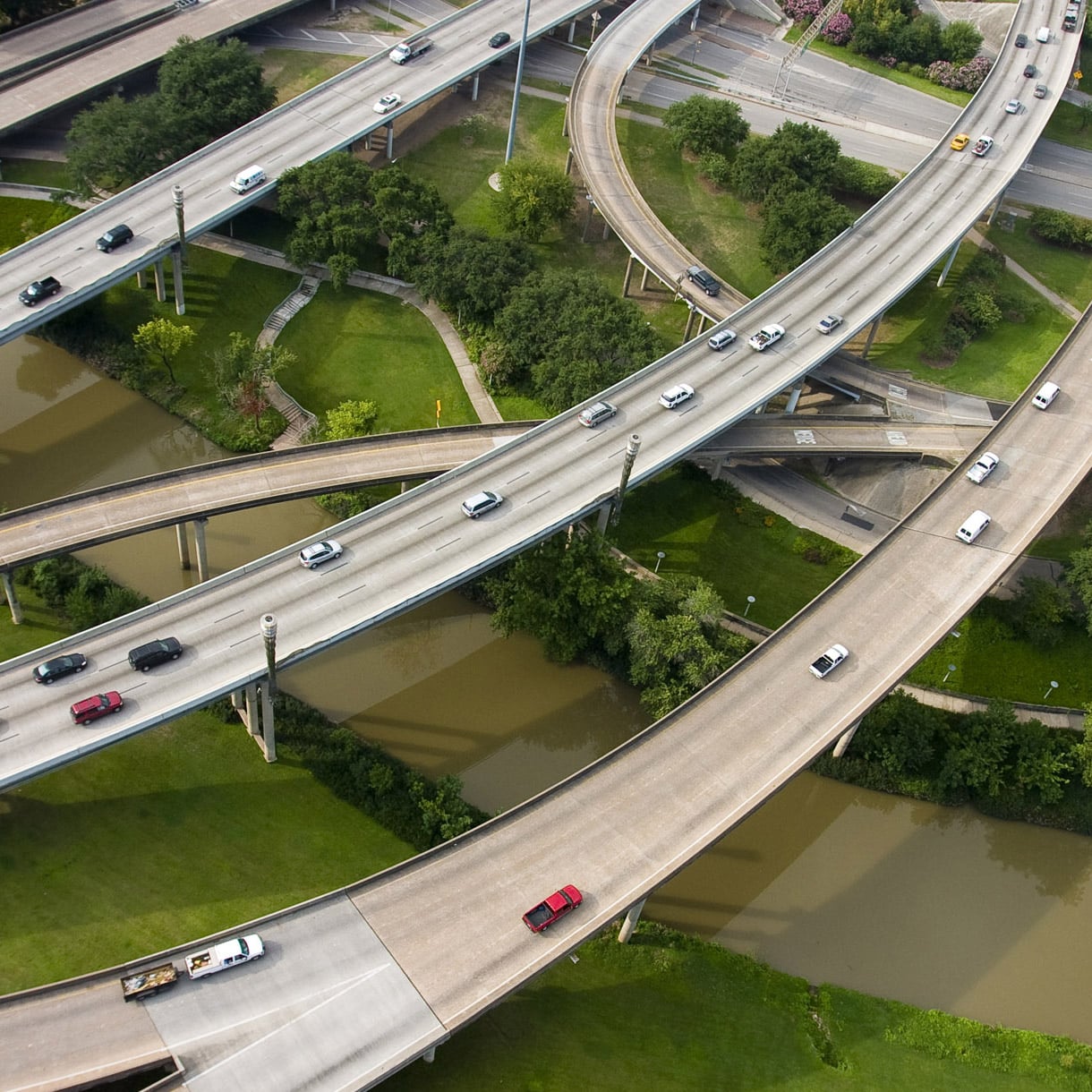
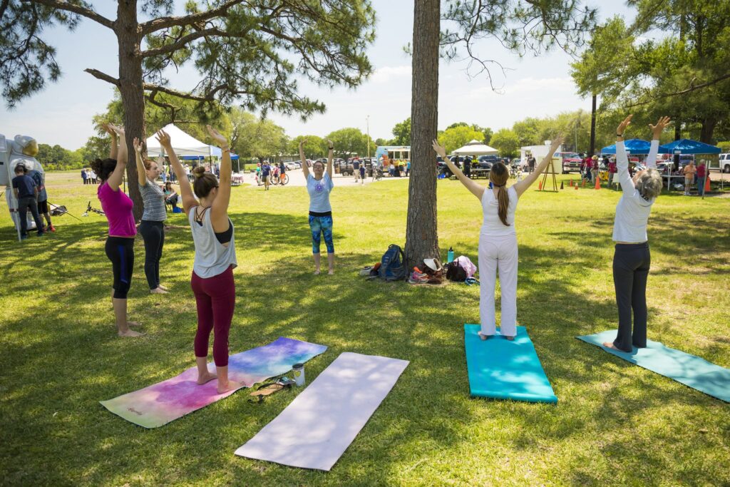
Buffalo Bayou Park transformed a derelict drainage basin beneath a tangle of highway infrastructure into a treasured parkland in the heart of Houston, Texas.

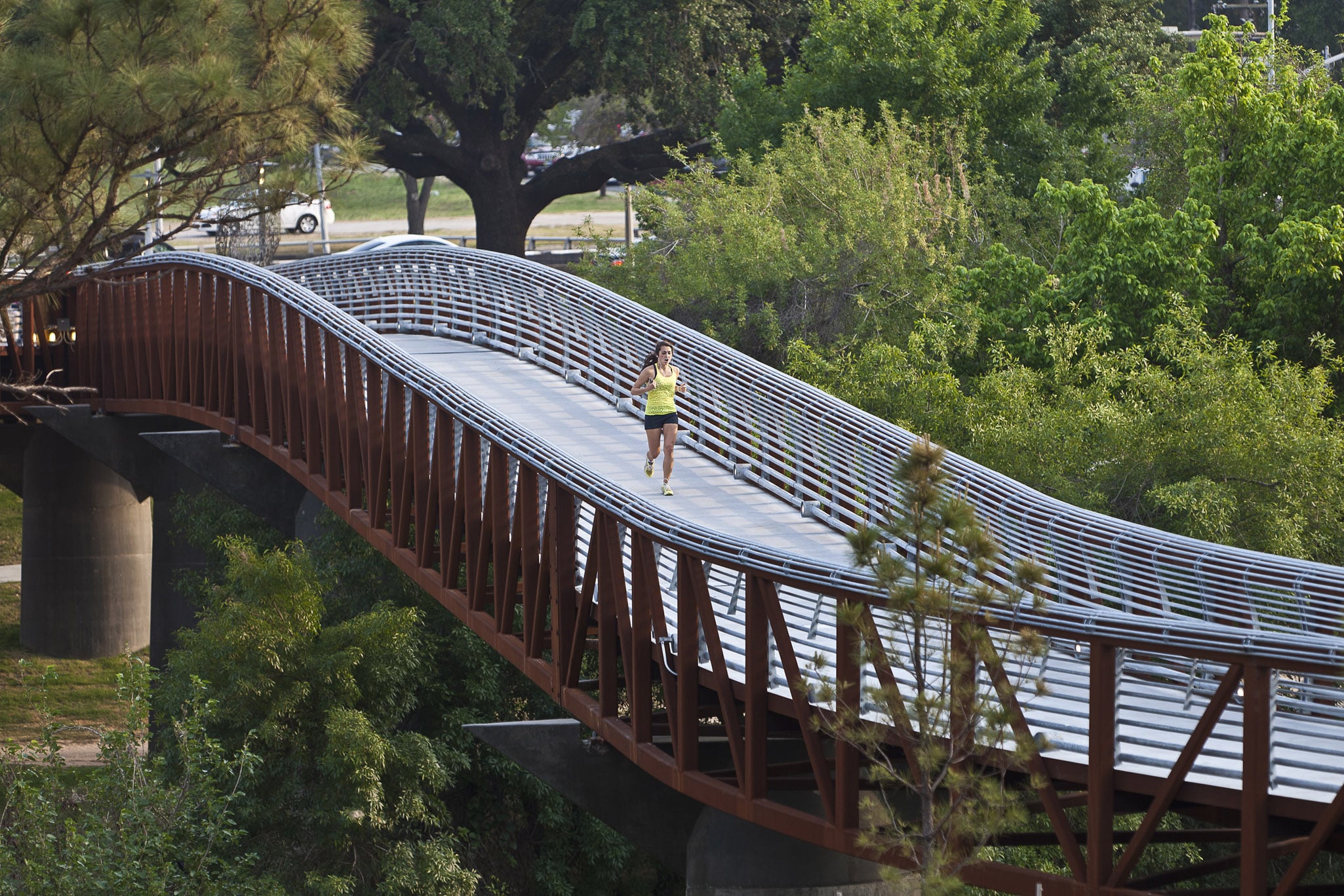
This 160-acre public space improves urban ecology by replacing 50 percent of turf in favor of native woodlands and meadows. It has improved pedestrian and bike accessibility, providing four new bridges connecting surrounding neighborhoods, a variety of trails, and public art. It stands as a model of resilience, having emerged unscathed after Hurricane Harvey.

Learn More

Maximize Land Benefits

Improvements to open space can be designed to offer multiple rewards – not only buffers for floods or wildfires and opportunities to reduce urban heat island effect, but also environments for recreation and renewal.

Project Examples
Buffalo Bayou Park

Buffalo Bayou Park transformed a derelict drainage basin beneath a tangle of highway infrastructure into a treasured parkland in the heart of Houston, Texas.

This 160-acre public space improves urban ecology by replacing 50 percent of turf in favor of native woodlands and meadows. It has improved pedestrian and bike accessibility, providing four new bridges connecting surrounding neighborhoods, a variety of trails, and public art. It stands as a model of resilience, having emerged unscathed after Hurricane Harvey.

Learn More

Leverage Forgotten Spaces

Land adjacent to underpasses, easements, and floodplains can become valuable additions to civic “common ground” that complement infrastructure.

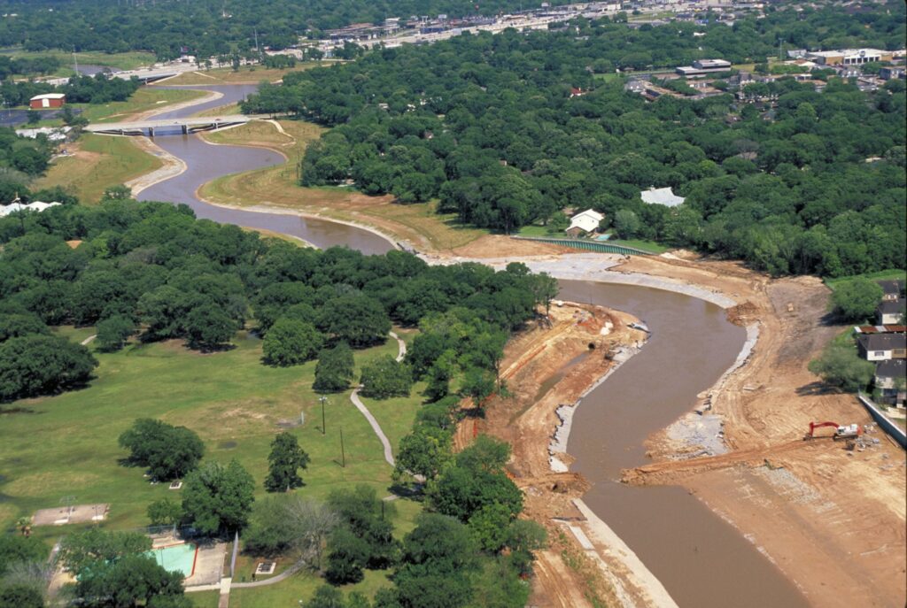
Sims Bayou

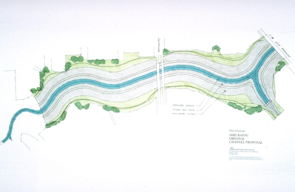
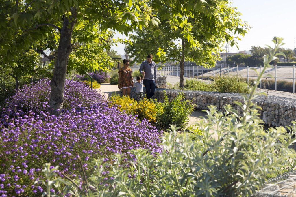
Sims Bayou is the first step in a long-range plan for watershed greenbelts in Houston, Texas to control flooding while offering wildlife habitat and recreational opportunities.

0
mi

The 20-mile-long stream was slated to be widened and concrete-channelized, but the community protested impacts to the tree-lined bayou, and neighborhoods affected by flooding needed a better solution. SWA took cues from nature to handle annual flows, widening the channel even further than originally planned with earthen grading, and added trees and other plantings. Since these interventions, Sims Bayou has experienced no intrusive flooding.

Learn More

Park 101

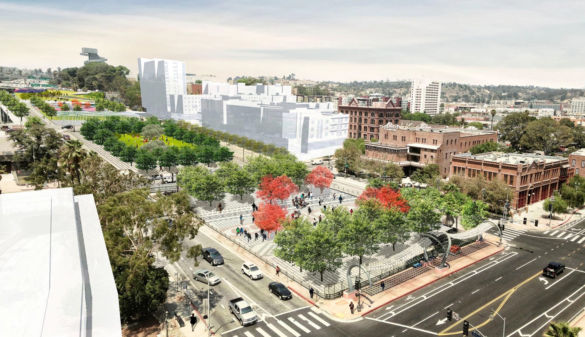
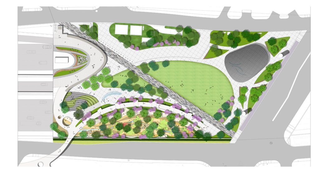
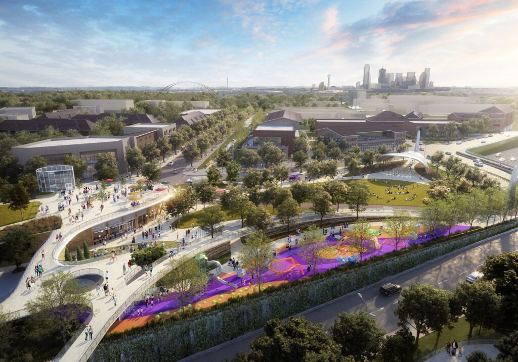
Park 101 aims to cover part of downtown Los Angeles’ 101 Freeway with a multi-purpose cap park that will include playgrounds, seating, festival areas, and a plaza. The approximately four-block park reconnects a divided downtown with much-needed shade and green space. Cap parks are increasingly seen as the future of green space in urban areas; SWA’s experience with on-structure parks in Asia imparted important lessons.

Learn More

Leverage Forgotten Spaces

Land adjacent to underpasses, easements, and floodplains can become valuable additions to civic “common ground” that complement infrastructure.

0
mi
Project Examples
Sims Bayou

Sims Bayou is the first step in a long-range plan for watershed greenbelts in Houston, Texas to control flooding while offering wildlife habitat and recreational opportunities.

The 20-mile-long stream was slated to be widened and concrete-channelized, but the community protested impacts to the tree-lined bayou, and neighborhoods affected by flooding needed a better solution. SWA took cues from nature to handle annual flows, widening the channel even further than originally planned with earthen grading, and added trees and other plantings. Since these interventions, Sims Bayou has experienced no intrusive flooding.

Learn More

Park 101

Park 101 aims to cover part of downtown Los Angeles’ 101 Freeway with a multi-purpose cap park that will include playgrounds, seating, festival areas, and a plaza. The approximately four-block park reconnects a divided downtown with much-needed shade and green space. Cap parks are increasingly seen as the future of green space in urban areas; SWA’s experience with on-structure parks in Asia imparted important lessons.

Learn More

Realize Resilience

Smarter choices about where and how land is developed can result in more resilient patterns, with benefits ranging from fire prevention to flood mitigation – benefiting both people and their environments.

Exploration Green

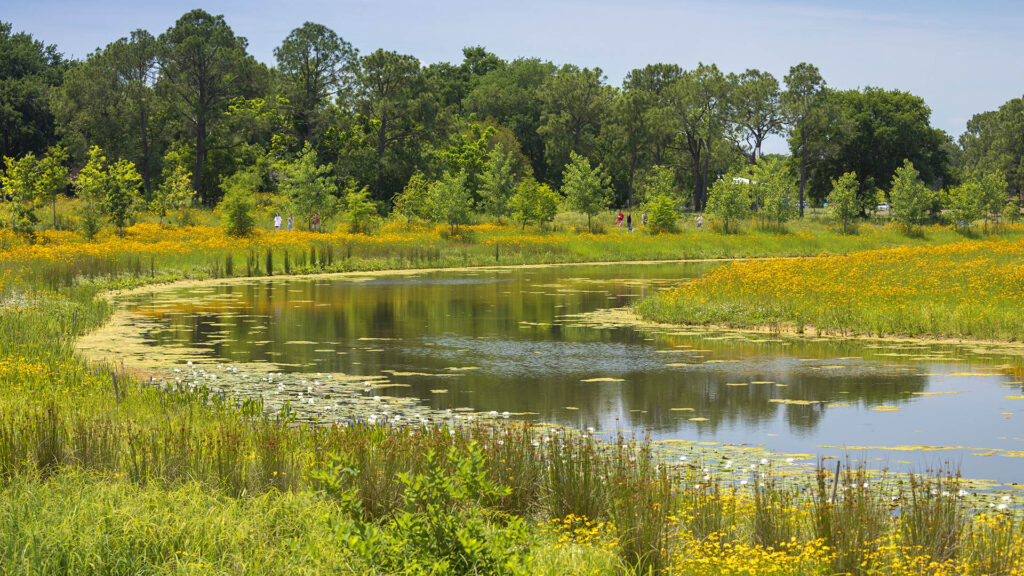
Exploration Green, in Houston, Texas, transformed a struggling golf course into a flood-reducing public open space.

The site has become a large nature park with ample trails, habitat supporting bird migration and nesting, and maximal floodwater retention, adding 1,680 acre-feet of storage and 39 acres of constructed wetlands.

Learn More

0
ac

Realize Resilience

Smarter choices about where and how land is developed can result in more resilient patterns, with benefits ranging from fire prevention to flood mitigation – benefiting both people and their environments.

0
ac
Project Examples
Exploration Green

Exploration Green, in Houston, Texas, transformed a struggling golf course into a flood-reducing public open space.

The site has become a large nature park with ample trails, habitat supporting bird migration and nesting, and maximal floodwater retention, adding 1,680 acre-feet of storage and 39 acres of constructed wetlands.

Learn More

“Every transportation decision is inherently a decision about equity. We want to proactively work with communities seeking to do the right thing, over and above the legal minimum.”
– Pete Buttigieg, U.S. Secretary of Transportation

Advance Equity
and Mobility

Traveling by public transportation is 10x safer than by car. It’s also cheaper! 93 percent of transportation expenses go to purchasing, fueling, and maintaining a personal vehicle. A household can save nearly $10K per year by using public transportation… making it a far more equitable means of “getting around” in urban areas with good infrastructure.

Traveling by public transportation is 10x safer than by car. It’s also cheaper! 93 percent of transportation expenses go to purchasing, fueling, and maintaining a personal vehicle. A household can save nearly $10K per year by using public transportation… making it a far more equitable means of “getting around” in urban areas with good infrastructure.

Complete Streets

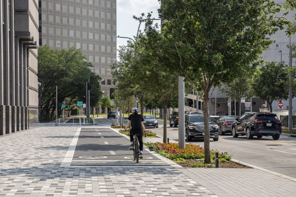
Roads and rail infrastructure can be adapted for additional forms of mobility, including biking and walking, resulting in reduced carbon emissions and a more engaging and safer network for civic life.

Bagby Street

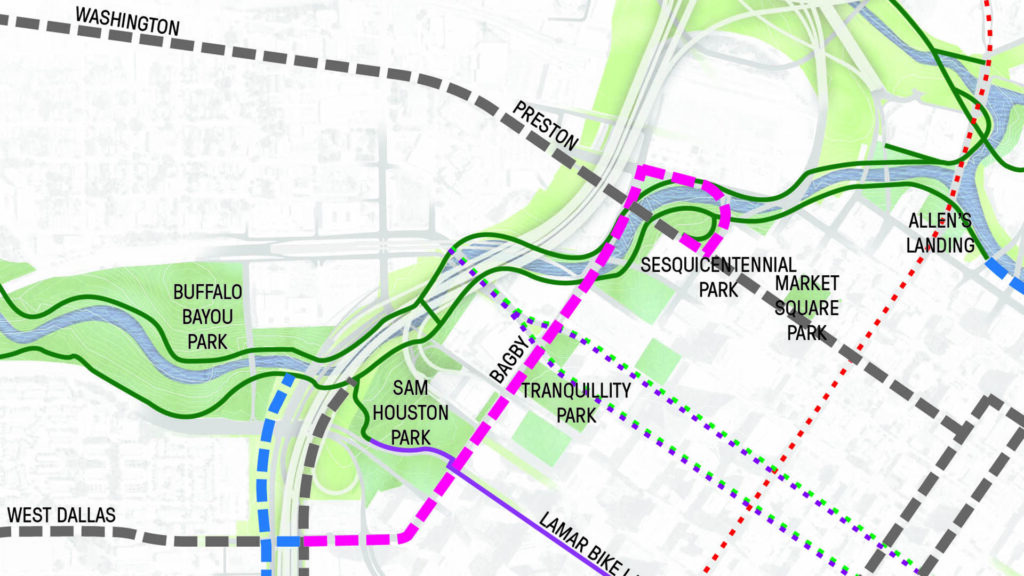
While Houston’s Bagby Street performed at an “acceptable or better level-of-service” according to traffic engineers focused largely on cars, it was underperforming at a human level, with barricaded sidewalks and crumbling wheelchair ramps.

Now, this urban trail provides a safe, off-street bike path through downtown, connecting to civic and cultural uses as well as parks, and serving as a gateway into downtown from the city’s west side. It is also a major step in stitching together the region’s emerging bike network.

Learn More

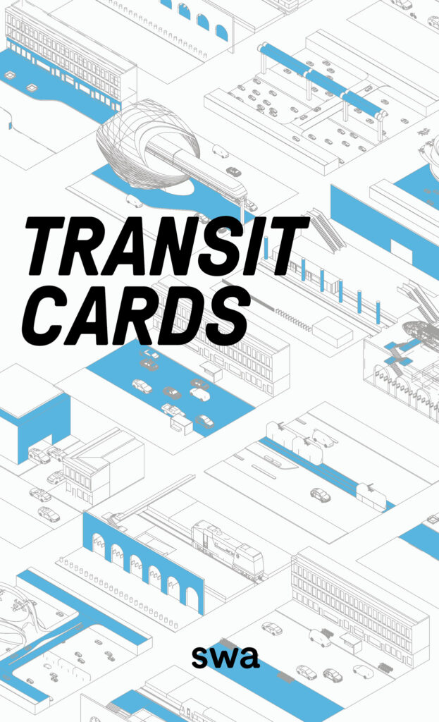
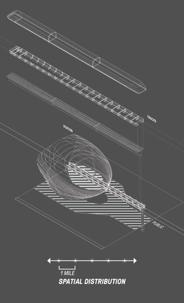
SWA’s Transit Cards

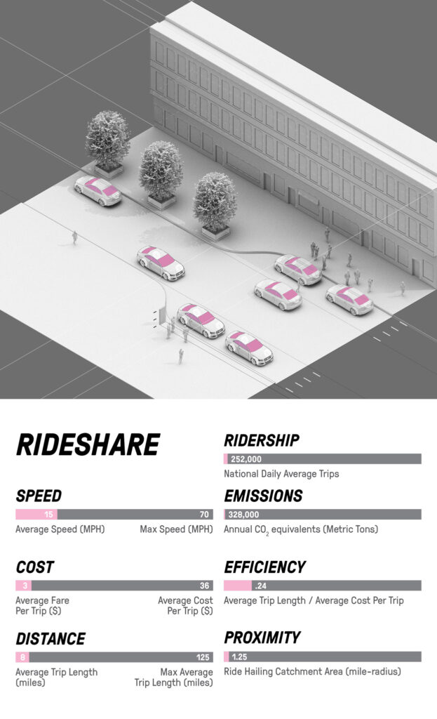
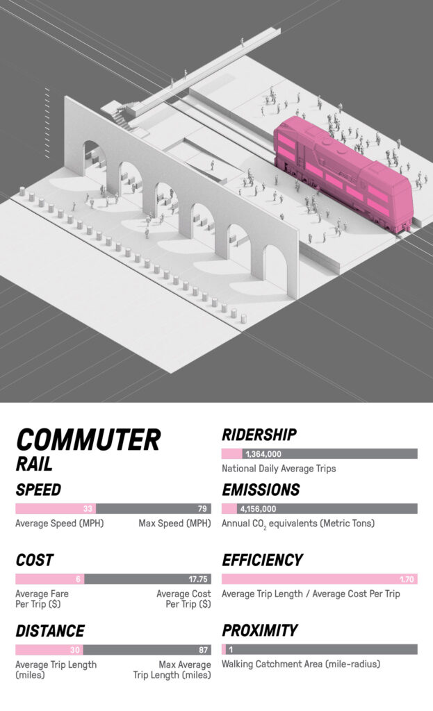
“SWA’s Transit Cards explore typological design strategies for topics related to landscape architecture, planning, urbanism, and resilience. These cards specifically illustrate best-practice urban deployment of existing and emerging modes of transit, highlighting specific infrastructure requirements in the operation of each transit type, as well as their relationships within the public and private realms.”
– Elvis Wong, SWA Associate and Co-Researcher, XL Transit Cards

Complete Streets

Roads and rail infrastructure can be adapted for additional forms of mobility, including biking and walking, resulting in reduced carbon emissions and a more engaging and safer network for civic life.

Project Examples
Bagby Street

While Houston’s Bagby Street performed at an “acceptable or better level-of-service” according to traffic engineers focused largely on cars, it was underperforming at a human level, with barricaded sidewalks and crumbling wheelchair ramps.

Now, this urban trail provides a safe, off-street bike path through downtown, connecting to civic and cultural uses as well as parks, and serving as a gateway into downtown from the city’s west side. It is also a major step in stitching together the region’s emerging bike network.

Learn More

SWA’s Transit Cards

“SWA’s Transit Cards explore typological design strategies for topics related to landscape architecture, planning, urbanism, and resilience. These cards specifically illustrate best-practice urban deployment of existing and emerging modes of transit, highlighting specific infrastructure requirements in the operation of each transit type, as well as their relationships within the public and private realms.”
– Elvis Wong, SWA Associate and Co-Researcher, XL Transit Cards

Reclaim the Lane

Capturing and transforming vehicular roadways can reduce car traffic and accommodate new uses that improve street life.

Avenida Houston

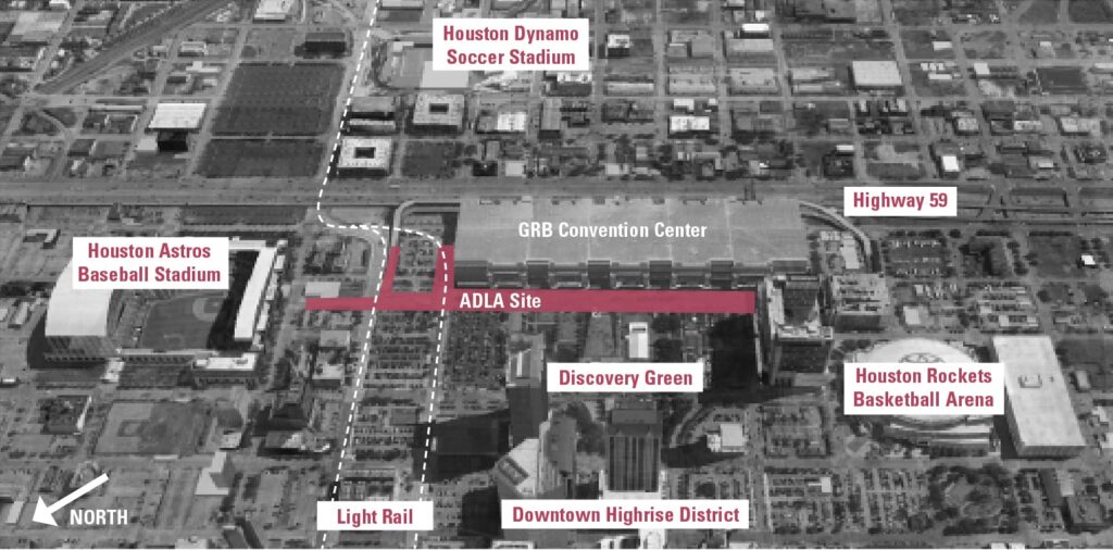
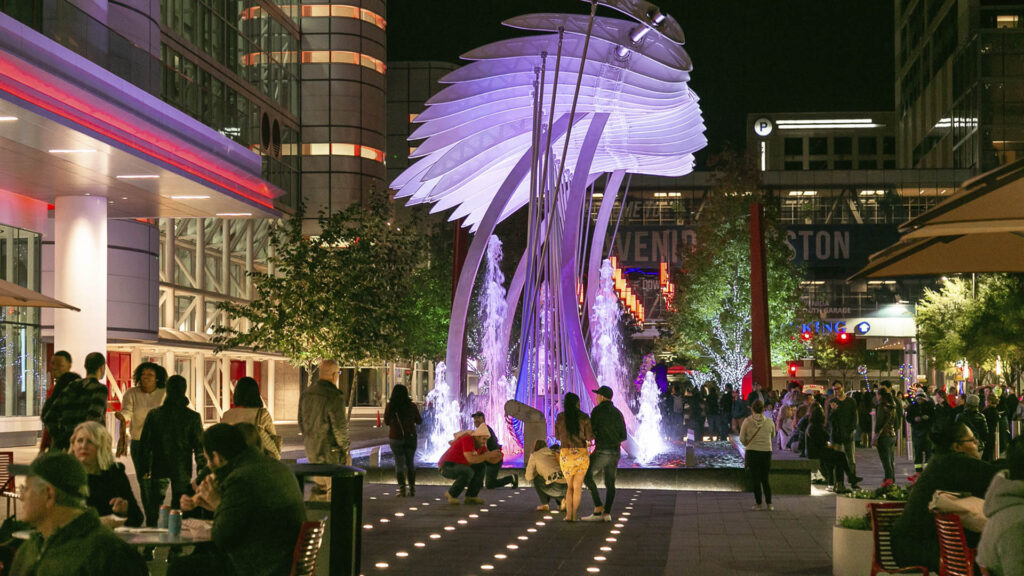
Avenida Houston transformed an eight-lane speed zone in front of the George R. Brown Convention Center into a pedestrian-friendly setting for sport celebrations, recreational activities, art, dining, and entertainment.

Avenida Houston runs between the Convention Center and Discovery Green Park, and connects the Toyota Center Arena with Minute Maid Ballpark. The plaza has limited vehicular through-access, flexible community space, and several zones that combine to present a multi-dimensional urban district and civic center.

Learn More

Promenade on Forest

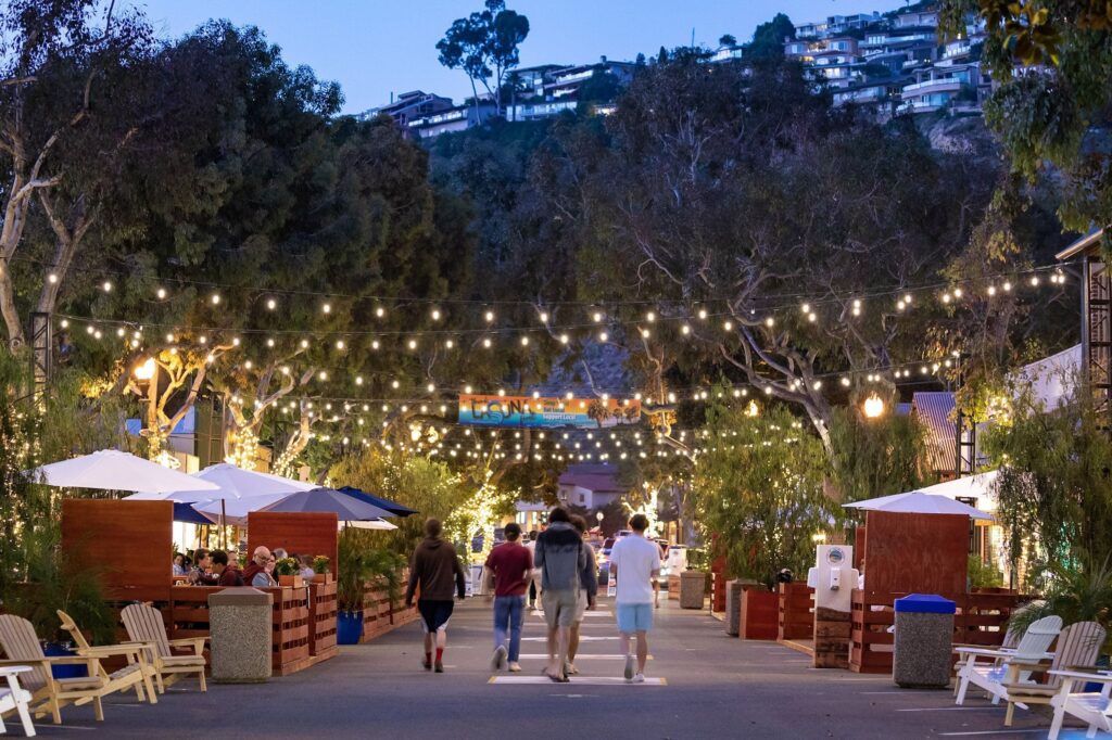
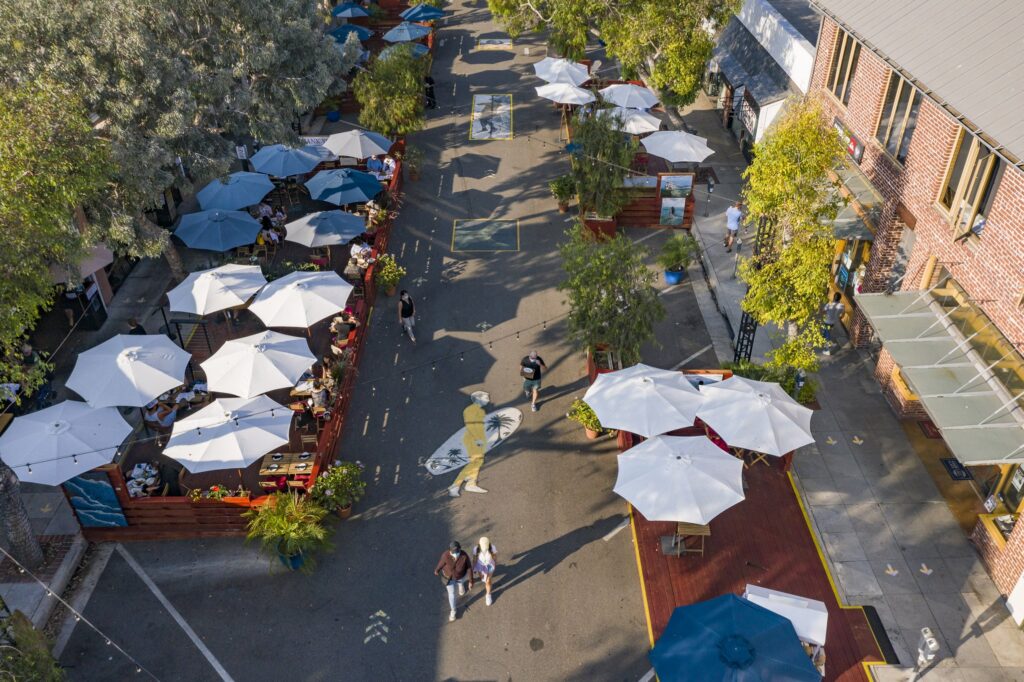
The Promenade on Forest reconfigured one of downtown Laguna Beach’s primary streets into a pedestrian-only promenade for the summer of 2020. The effort converted a three-block section of the road from a one-way vehicular and parking corridor into a car-free zone with café seating, local art, and retail display areas, and supported local businesses impacted by COVID-19. With three wooden decks and movable chairs and tables, restaurants could offer dining space while adhering to social distancing requirements.

Learn More

Reclaim the Lane

Capturing and transforming vehicular roadways can reduce car traffic and accommodate new uses that improve street life.

Project Examples
Avenida Houston

Avenida Houston transformed an eight-lane speed zone in front of the George R. Brown Convention Center into a pedestrian-friendly setting for sport celebrations, recreational activities, art, dining, and entertainment.

Avenida Houston runs between the Convention Center and Discovery Green Park, and connects the Toyota Center Arena with Minute Maid Ballpark. The plaza has limited vehicular through-access, flexible community space, and several zones that combine to present a multi-dimensional urban district and civic center.

Learn More

Promenade on Forest

The Promenade on Forest reconfigured one of downtown Laguna Beach’s primary streets into a pedestrian-only promenade for the summer of 2020. The effort converted a three-block section of the road from a one-way vehicular and parking corridor into a car-free zone with café seating, local art, and retail display areas, and supported local businesses impacted by COVID-19. With three wooden decks and movable chairs and tables, restaurants could offer dining space while adhering to social distancing requirements.

Learn More

Repair the Rifts

Reinvestment has the opportunity to repair and restore communities fragmented by previous infrastructure projects.

Southern Gateway Public Green
Southern Gateway Rendering 2-min

The Southern Gateway Public Green caps South Dallas’ Highway 35 near the Dallas Zoo and Oak Cliff neighborhood, effectively reconnecting an area that was cleaved by the highway’s construction many decades ago. The design introduces a pedestrian promenade that expresses the importance of this street and doubles as a “history walk.” Here, interpretive elements are introduced to celebrate the people who have shaped this diverse, historic neighborhood.

Learn More

Ricardo Lara Park

Ricardo Lara Park demonstrates how a small investment and creative thinking about landscape can turn infrastructure that has divided and isolated a community into an amenity that unites it. More than five acres of vacant lots along an I-105 freeway embankment were transformed into a mile-long park that filters stormwater runoff (equivalent to six swimming pools per year), improves air quality, and provides multiple outdoor gathering spaces, including a dog park, fitness stations, play structures, and community gardens.

Learn More

Repair the Rifts

Reinvestment has the opportunity to repair and restore communities fragmented by previous infrastructure projects.

Project Examples
Southern Gateway Public Green

The Southern Gateway Public Green caps South Dallas’ Highway 35 near the Dallas Zoo and Oak Cliff neighborhood, effectively reconnecting an area that was cleaved by the highway’s construction many decades ago. The design introduces a pedestrian promenade that expresses the importance of this street and doubles as a “history walk.” Here, interpretive elements are introduced to celebrate the people who have shaped this diverse, historic neighborhood.

Learn More

Southern Gateway Rendering 2-min
Ricardo Lara Park

Ricardo Lara Park demonstrates how a small investment and creative thinking about landscape can turn infrastructure that has divided and isolated a community into an amenity that unites it. More than five acres of vacant lots along an I-105 freeway embankment were transformed into a mile-long park that filters stormwater runoff (equivalent to six swimming pools per year), improves air quality, and provides multiple outdoor gathering spaces, including a dog park, fitness stations, play structures, and community gardens.

Learn More

Make Transit Common Ground

Bus, train, and subway stations are impromptu gathering areas, offering opportunities to enhance access to mobility and express community identity.

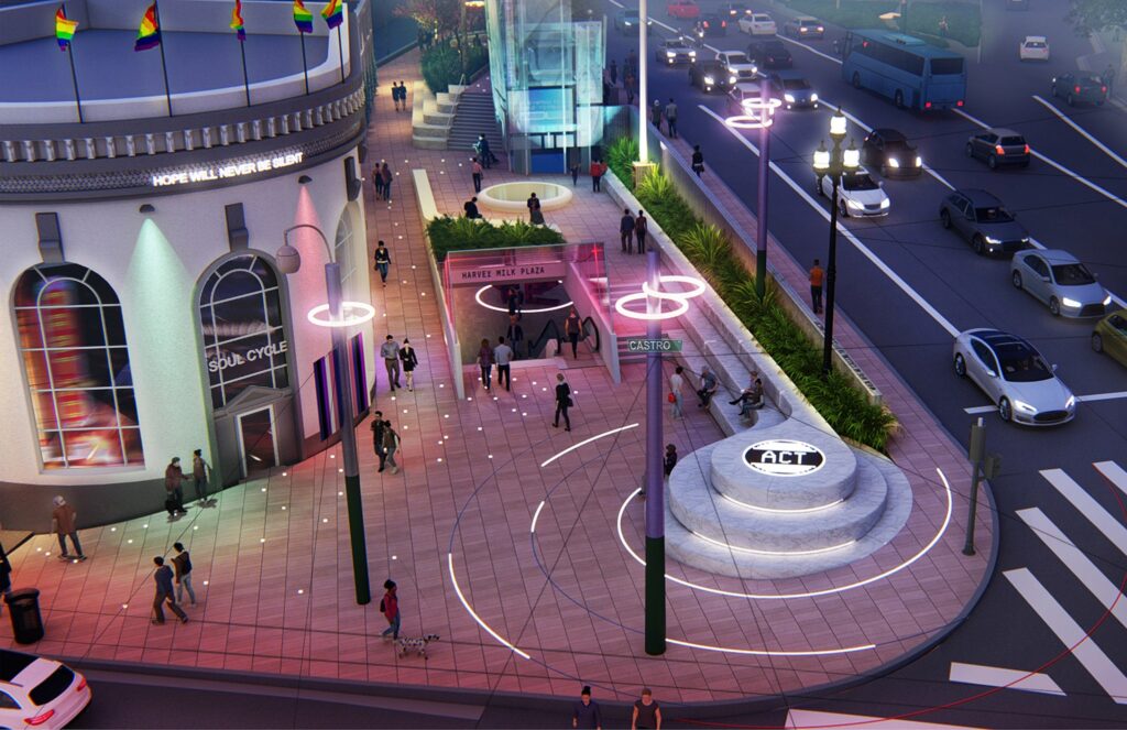
The Memorial at Harvey Milk Plaza

The Memorial at Harvey Milk Plaza is located in the heart of San Francisco’s Castro Neighborhood, at one of the city’s busiest transit hubs.

“Cities provide opportunities for climate action… transport systems that connect urban and rural areas can lead to a more inclusive, fairer society.”
– Debra Roberts, Co-Chair, Intergovernmental Panel on Climate Change (IPCC)

It has been the site of countless gatherings and protests. The redesigned plaza honors Harvey Milk, the United States’ first openly gay public official, and memorializes his 1978 assassination through public art and interactive elements that celebrate LGBTQ+ culture and history. The plaza also serves to promote calls to action in support of social justice movements, making it a place where hope and action live on forever.

Learn More

Make Transit Common Ground

Bus, train, and subway stations are impromptu gathering areas, offering opportunities to enhance access to mobility and express community identity.

Project Examples
The Memorial at Harvey Milk Plaza

The Memorial at Harvey Milk Plaza is located in the heart of San Francisco’s Castro Neighborhood, at one of the city’s busiest transit hubs.

“Cities provide opportunities for climate action… transport systems that connect urban and rural areas can lead to a more inclusive, fairer society.”
– Debra Roberts, Co-Chair, Intergovernmental Panel on Climate Change (IPCC)

It has been the site of countless gatherings and protests. The redesigned plaza honors Harvey Milk, the United States’ first openly gay public official, and memorializes his 1978 assassination through public art and interactive elements that celebrate LGBTQ+ culture and history. The plaza also serves to promote calls to action in support of social justice movements, making it a place where hope and action live on forever.

Learn More

Reconnect

People should have equitable access to their entire communities, including open space. Repurposed infrastructural routes can act as connective tissue, yielding  transformative outcomes.

Katy Trail

Katy Trail, in Dallas, Texas, exemplifies the ways in which abandoned and out-of-service rail lines throughout the U.S. can be repurposed to better connect neighborhoods and boost access to nature.

The abandoned Missouri-Kansas-Texas line (better known as the “Katy”) line, now provides approximately 3.5 miles of intercity bicycle and pedestrian trail for for jogging, passive nature interpretation, and walking. The trail links approximately 20 neighborhoods to the Central Business District and other key areas. The value of properties adjacent to the trail has soared, adding economic revitalization to the project’s list of benefits.

Learn More

Downtown Houston Freeways

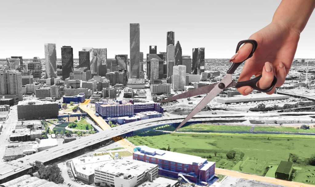
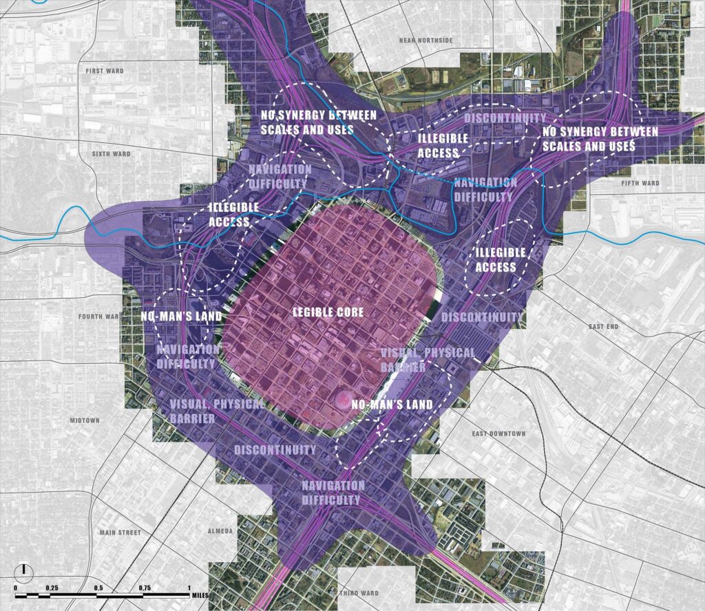
Working with a variety of stakeholder groups, SWA produced three new “storylines” for the Downtown Houston Freeways, examining alternative structures and configurations for the freeways surrounding the city’s center. The preferred scheme relocates I-45 to the East side of Downtown, repurposing its footprint with an at-grade parkway that reconnects adjacent districts and creates additional green space along the roadway and the bayous. This parkway would then feed directly into the grid of the downtown streets, serving the district in ways other than simply the conveyance of vehicles.

Learn More

Reconnect

People should have equitable access to their entire communities, including open space. Repurposed infrastructural routes can act as connective tissue, yielding  transformative outcomes.

Project Examples
Katy Trail

Katy Trail, in Dallas, Texas, exemplifies the ways in which abandoned and out-of-service rail lines throughout the U.S. can be repurposed to better connect neighborhoods and boost access to nature.

The abandoned Missouri-Kansas-Texas line (better known as the “Katy”) line, now provides approximately 3.5 miles of intercity bicycle and pedestrian trail for for jogging, passive nature interpretation, and walking. The trail links approximately 20 neighborhoods to the Central Business District and other key areas. The value of properties adjacent to the trail has soared, adding economic revitalization to the project’s list of benefits.

Learn More

Downtown Houston Freeways

Working with a variety of stakeholder groups, SWA produced three new “storylines” for the Downtown Houston Freeways, examining alternative structures and configurations for the freeways surrounding the city’s center. The preferred scheme relocates I-45 to the East side of Downtown, repurposing its footprint with an at-grade parkway that reconnects adjacent districts and creates additional green space along the roadway and the bayous. This parkway would then feed directly into the grid of the downtown streets, serving the district in ways other than simply the conveyance of vehicles.

Learn More

“The Bipartisan Infrastructure Deal is a ‘down payment’ ensuring that future generations have clean air, drinkable water, fertile soil, and an overall quality of life that is currently threatened by the worsening climate crisis.”
– Deb Haaland, U.S. Secretary of the Interior

Healthy, Connected, and Accessible

Due to climate change, “One-in-100-year floods” are occurring so frequently that the term has lost meaning. Between 1988 and 2017, costs from flood damages soared to $73 billion.

Due to climate change, “One-in-100-year floods” are occurring so frequently that the term has lost meaning. Between 1988 and 2017, costs from flood damages soared to $73 billion.

Welcome the Water

Flooding is among the most common environmental hazards, and it’s on the rise. Creative adaptations to waterways offer their cities regenerative opportunities—environmental, economic, and recreational.

Bray’s Bayou

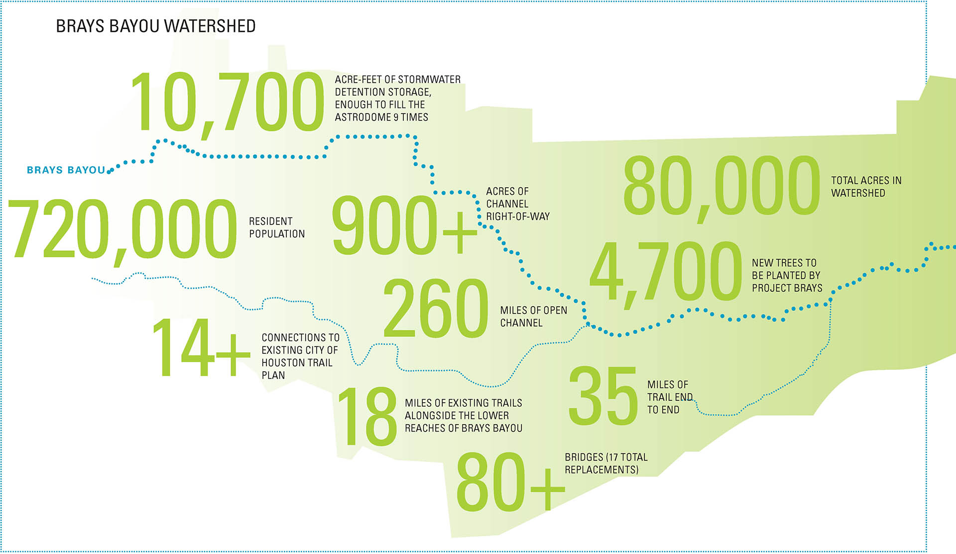
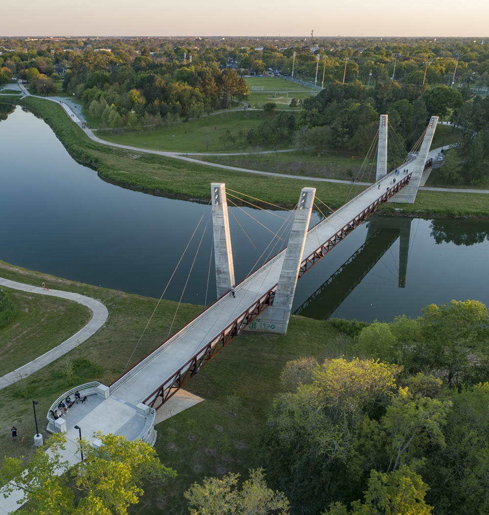
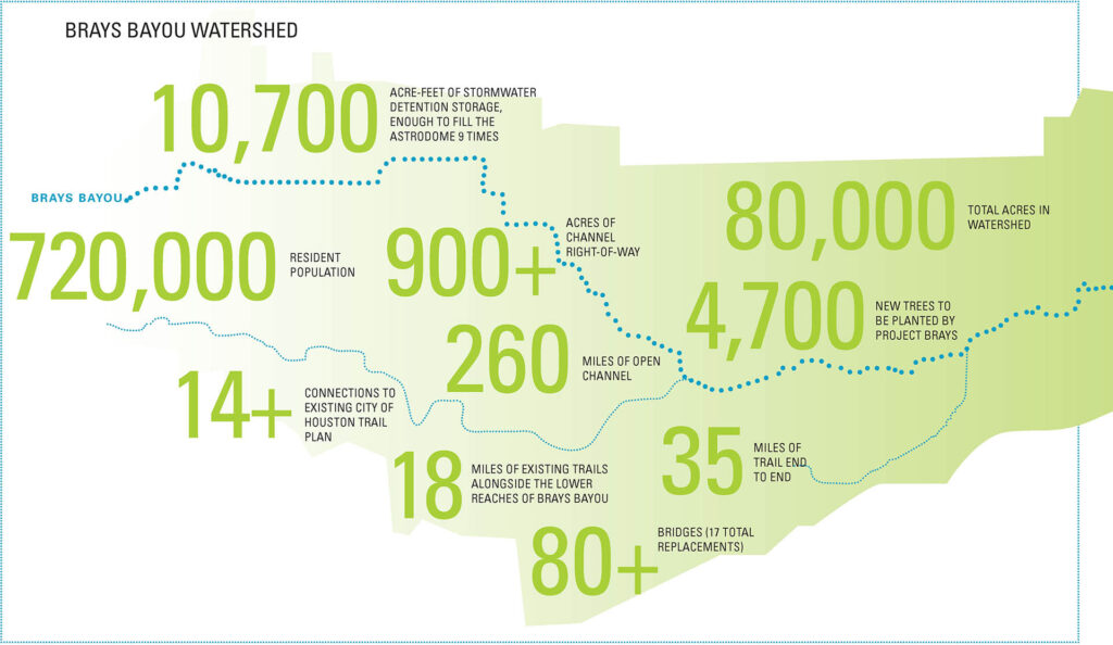
Bray’s Bayou, stretching 35 miles from the mouth of the Houston Ship channel westward through residential, commercial, and institutional developments, is one of the county’s most important local waterways.

The urban design framework presented solutions for flood protection that balance urban recreation, habitat preservation, aesthetic beauty, and cultural enhancements. The effort defines the character of greenways and opportunities for habitat improvements within the channel’s right-of-way. SWA also produced architectural guidelines for the reconstruction of numerous retaining walls and more than 30 bridges that span the bayou.

Learn More

Welcome the Water

Flooding is among the most common environmental hazards, and it’s on the rise. Creative adaptations to waterways offer their cities regenerative opportunities—environmental, economic, and recreational.

Project Examples
Bray’s Bayou

Bray’s Bayou, stretching 35 miles from the mouth of the Houston Ship Channel westward through residential, commercial, and institutional developments, is one of the county’s most important local waterways.

The urban design framework presented solutions for flood protection that balance urban recreation, habitat preservation, aesthetic beauty, and cultural enhancements. The effort defines the character of greenways and opportunities for habitat improvements within the channel’s right-of-way. SWA also produced architectural guidelines for the reconstruction of numerous retaining walls and more than 30 bridges that span the bayou.

Learn More

Soften the Edge

Thoughtfully designed parks and open space can double as coastal infrastructure, absorbing rising seas. As cities clean up and redevelop large industrial sites along their waterways, they have the opportunity to rethink the edge.

Hunter’s Point South

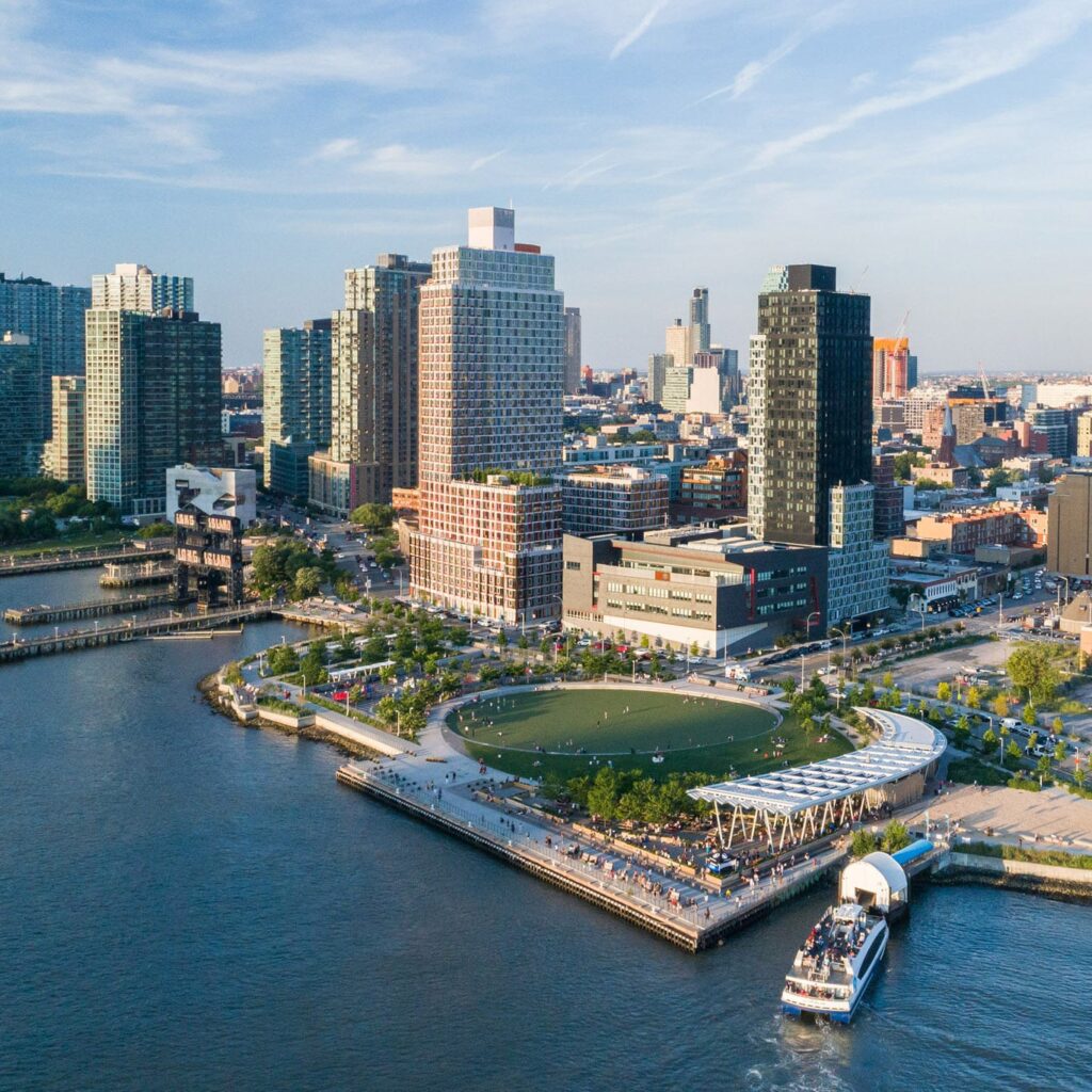
A collaboration among SWA/Balsley, Weiss/Manfredi, and Arup, Hunter’s Point South Waterfront Park in Queens, New York is a model for waterfront resiliency and “living infrastructure.”

What was once a barren post-industrial site has been transformed into a world-class park which, by the time its first phase opened, had already survived Hurricane Sandy. Its bowl-shaped central green detained floodwaters, and its new trees and promenade emerged unscathed. The park’s second phase offers an urban “island,” tidal marshes, trails, award-winning art, and dramatic views to Manhattan. Adjacent to an emerging affordable housing development, the park also provides much-needed open space for an underserved population.

Learn More

Soften the Edge

Thoughtfully designed parks and open space can double as coastal infrastructure, absorbing rising seas. As cities clean up and redevelop large industrial sites along their waterways, they have the opportunity to rethink the edge.

Project Examples
Hunter’s Point South

A collaboration among SWA/Balsley, Weiss/Manfredi, and Arup, Hunter’s Point South Waterfront Park in Queens, New York is a model for waterfront resiliency and “living infrastructure.”

What was once a barren post-industrial site has been transformed into a world-class park which, by the time its first phase opened, had already survived Hurricane Sandy. Its bowl-shaped central green detained floodwaters, and its new trees and promenade emerged unscathed. The park’s second phase offers an urban “island,” tidal marshes, trails, award-winning art, and dramatic views to Manhattan. Adjacent to an emerging affordable housing development, the park also provides much-needed open space for an underserved population.

Learn More

Green the Gray

Traditional approaches to channelized waterways have often divided and isolated poorer neighborhoods. Thoughtful design can transform or adapt these massive conduits into verdant community assets.

Milton Street Park

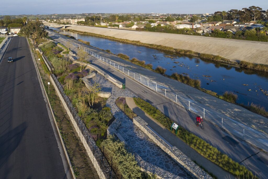
Milton Street Park reimagines a significant section of underutilized waterway infrastructure as a 1.2-acre linear urban park alongside Los Angeles’ Ballona Creek Bike Trail.

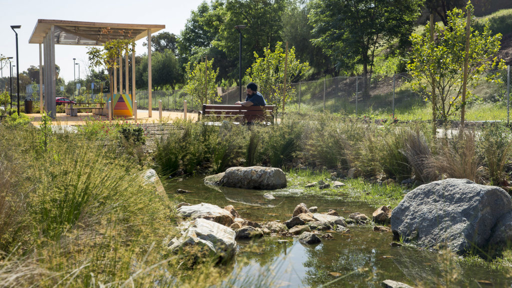
The park includes recycled materials, native planting, and flow-through planters, as well as bird-watching platforms, bike trail enhancements, seating, and outdoor picnic areas. This landmark development now promotes alternative transportation and establishes an interpretative ecological habitat for birds, insects, and reptiles. It also demonstrates how infrastructural barriers that have compromised surrounding neighborhoods can be redeveloped as open space assets, directly addressing issues of social justice.

Learn More

Green the Gray

Traditional approaches to channelized waterways have often divided and isolated poorer neighborhoods. Thoughtful design can transform or adapt these massive conduits into verdant community assets.

“Cities provide opportunities for climate action… transport systems that connect urban and rural areas can lead to a more inclusive, fairer society.”
– Debra Roberts, Co-Chair, Intergovernmental Panel on Climate Change (IPCC)

Project Examples
Milton Street Park

Milton Street Park reimagines a significant section of underutilized waterway infrastructure as a 1.2-acre linear urban park alongside Los Angeles’ Ballona Creek Bike Trail.

The park includes recycled materials, native planting, and flow-through planters, as well as bird-watching platforms, bike trail enhancements, seating, and outdoor picnic areas. This landmark development now promotes alternative transportation and establishes an interpretative ecological habitat for birds, insects, and reptiles. It also demonstrates how infrastructural barriers that have compromised surrounding neighborhoods can be redeveloped as open space assets, directly addressing issues of social justice.

Learn More

Plant the City

Trees in urban settings serve several essential functions related to climate change: reducing heat island effect, supporting more livable communities, and reducing wildfire risk.

Thousand Oaks

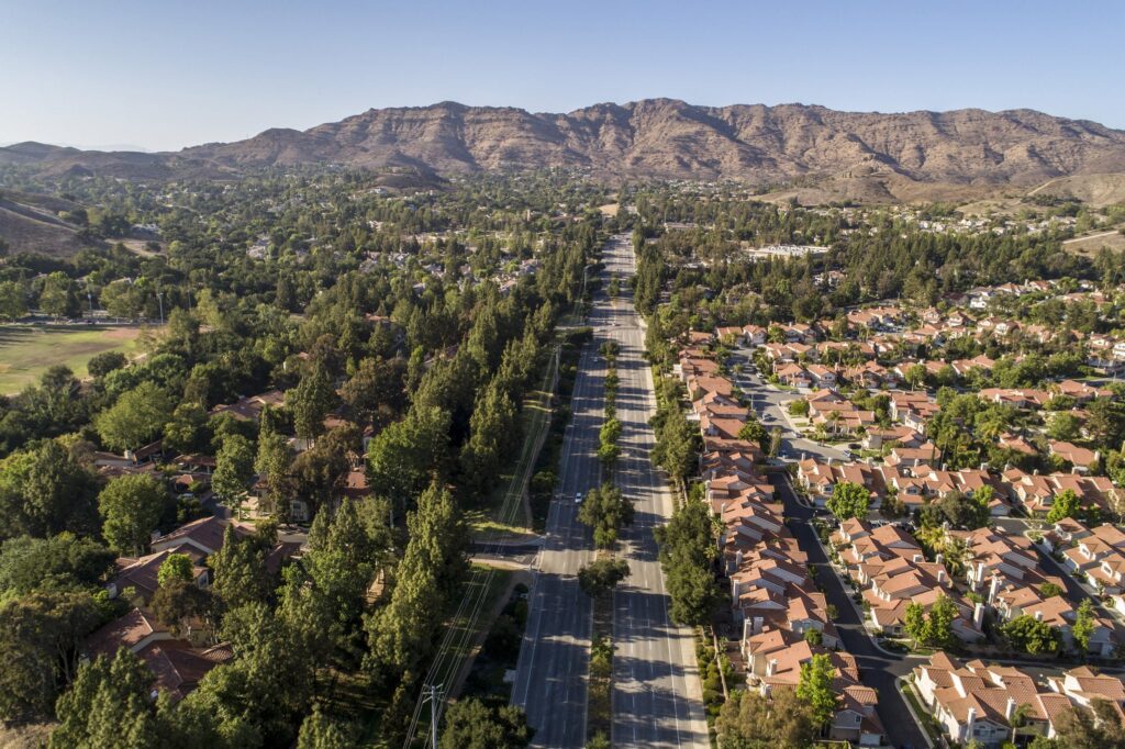
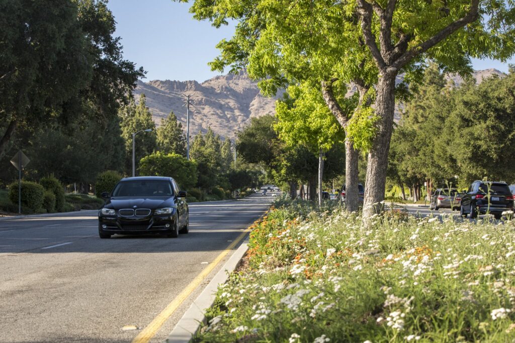
The Thousand Oaks Urban Forestry Master Plan builds upon this Southern California town’s legacy as “Tree City USA” – a two-decade-long distinction of which residents are justifiably proud.

Drought conditions created the need to update a 26-year-old Forestry Master Plan. SWA worked with Planning & Energy/Entitlement Services, Rincon, City staff, and the local community to develop plant palettes, planting guidelines, and maintenance recommendations that will help the City sustainably manage their community forest.

Learn More

Portsmouth Square

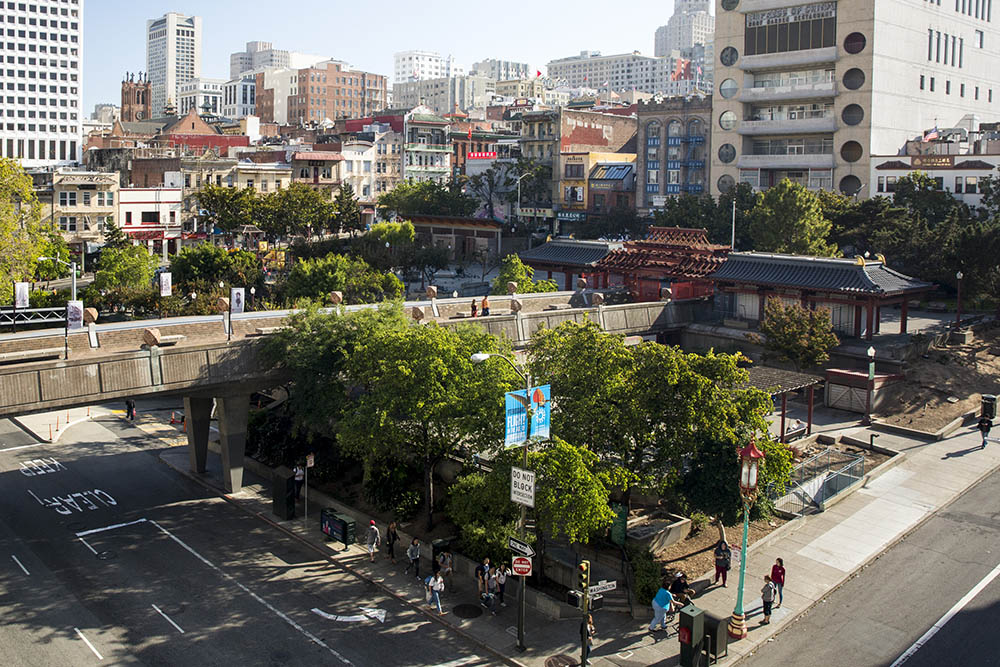
Portsmouth Square is the heart of San Francisco’s Chinatown: the main civic park for all community festivals and events as well as an important day-to-day outdoor “living room” for the densest community in the United States west of the Hudson River. More than 40 percent of local residents live in single-occupancy units, making green space and shade critical for their health and well-being. The new outdoor “living room” pairs urban forestry techniques with green roofs, stormwater design, solar power, and high-albedo surfaces… all over an existing structure.

Learn More

Plant the City

Trees in urban settings serve several essential functions related to climate change: reducing heat island effect, supporting more livable communities, and reducing wildfire risk.

Project Examples
Thousand Oaks

The Thousand Oaks Urban Forestry Master Plan builds upon this Southern California town’s legacy as “Tree City USA” – a two-decade-long distinction of which residents are justifiably proud.

Drought conditions created the need to update a 26-year-old Forestry Master Plan. SWA worked with Planning & Energy/Entitlement Services, Rincon, City staff, and the local community to develop plant palettes, planting guidelines, and maintenance recommendations that will help the City sustainably manage their community forest.

Learn More

Portsmouth Square

Portsmouth Square is the heart of San Francisco’s Chinatown: the main civic park for all community festivals and events as well as an important day-to-day outdoor “living room” for the densest community in the United States west of the Hudson River. More than 40 percent of local residents live in single-occupancy units, making green space and shade critical for their health and well-being. The new outdoor “living room” pairs urban forestry techniques with green roofs, stormwater design, solar power, and high-albedo surfaces… all over an existing structure.

Learn More

Want to Learn More?

Enter your email address below to receive periodic mailings from SWA Group about landscape infrastructure and other ideas that influence the public realm.

    For business inquiries contact: infrastructure@swagroup.com