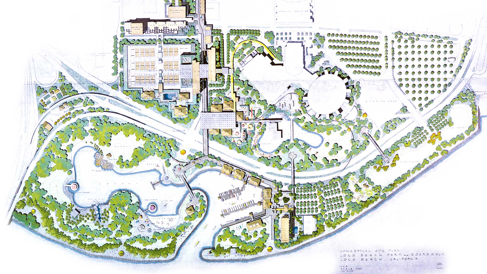
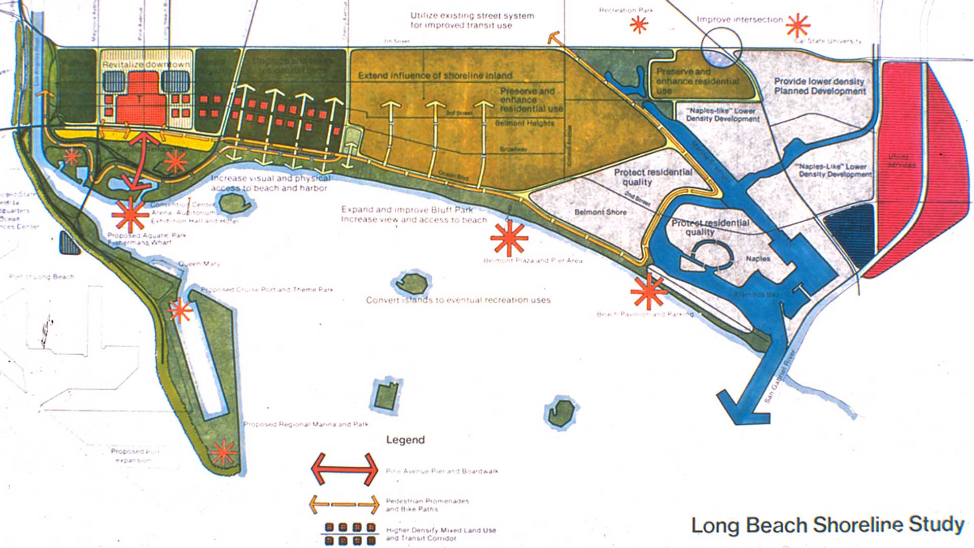
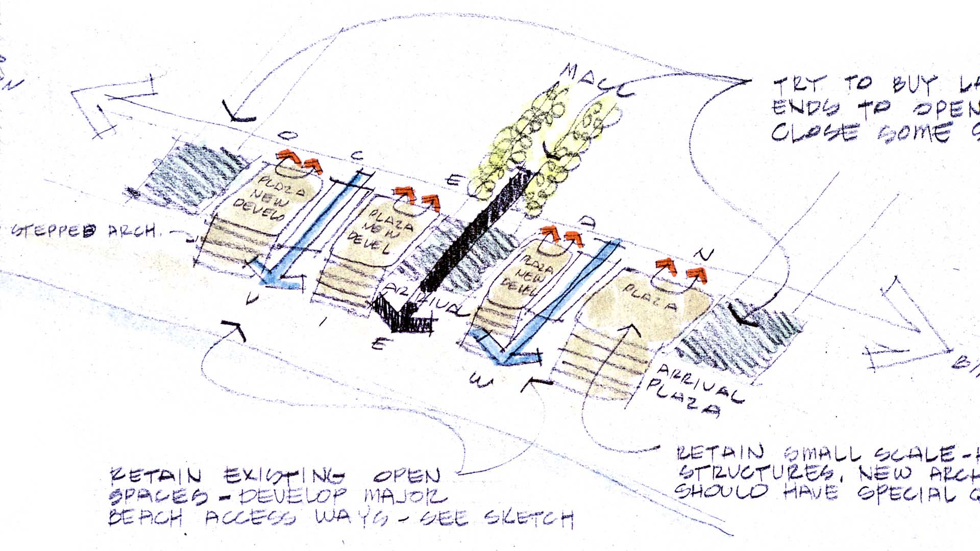
SWA prepared a land use and urban design plan for six miles of waterfront adjacent to downtown Long Beach. Through a series of meetings with local community stakeholders, we were able to determine the different needs of each district in the plan: of critical importance was the need to preserve valuable open space inland, and to maintain an ecological corridor for stormwater management along the shoreline. The resulting plan, endorsed by the California Coastal Commission, proposed improved road circulation, a continuous pedestrian boardwalk, marina and commercial development, and a 50-acre shoreline park. In addition to recommendations related to building density and height restrictions to preserve view corridors, SWA proposed several strategies for improving access to the coast from different points within the city. Specifically, we proposed a major new pedestrian spine linking downtown to the bay with provisions for new high-density office and residential development. Following approval of the plan, SWA was hired to perform more detailed studies of downtown development in support of the new convention center arena, performing arts center, Hyatt Regency hotel, and the Shoreline Village. The important recommendations made by SWA are still evident today in the distinct qualities of Long Beach’s downtown and shoreline neighborhoods.
Fort Wayne Riverfront
As a city that was built and thrived because of its location as a crossroads between wilderness and city, farm and market, the realities of infrastructure both natural and man-made are at the heart of Fort Wayne’s history. We consider waterways as an integral part of open spaces of the City, forming a series of infrastructural systems that affect the dynamics ...
Hangzhou Hubin
West Lake in Hangzhou, China, one of the world’s most romantic places and as familiar an icon as the Great Wall or the Forbidden City, has been designated by the United Nations as one of the World Cultural Heritage Sites. Seven hundred years later, the city that served ancient emperors as a capitol boasts a population of over three million and is still a...
Downtown Jebel Ali Landscape Master Plan, UAE
Downtown Jebel Ali is a new development located 35 kilometers southwest of Dubai, along an 11 km stretch of Sheikh Zayed Road. Representing the first phase of a major mixed-use development on the outskirts of Dubai, the project includes two high-rise office buildings and two high-rise apartment buildings with access to Sheik Zayed Road. Mixed-use buildings and...
Changsha Baxizhou Island
Over many decades, public agencies in China have sought to solve growing flooding issues in a defensive way: fortifying and hardening river edges, raising levee heights, and ultimately separating the people from historical connections to the water. With an understanding of river flow processes and volumes and of wetland and native forest ecology, this separati...


